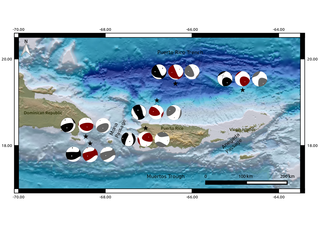
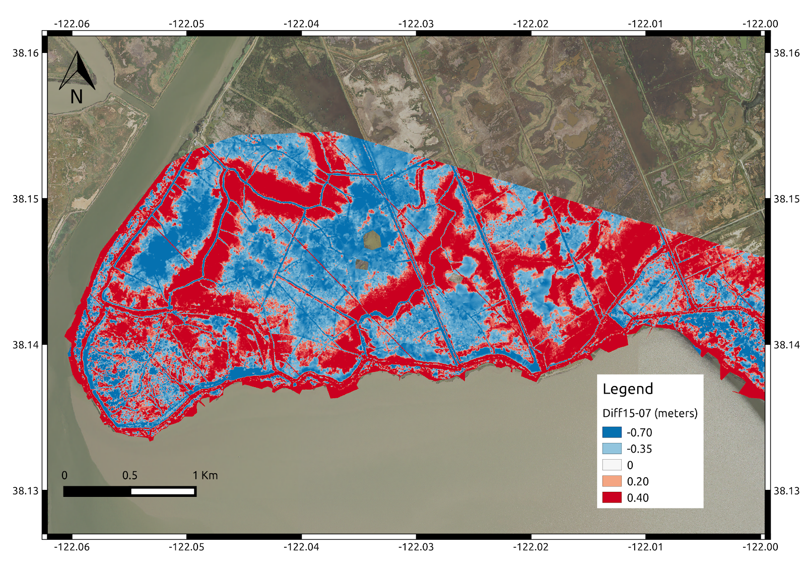
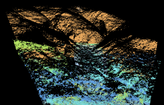
Data Visualization
Our team is compose by several data scientist with experience in data processing and visualization in different software’s and formats that included:
- Geographical Information System (GIS)
- Remote Sensing
- Google Earth Engine
- Minitab and R
- Tensor Flow
- MATLAB
- Matplotlib (Python)
- Excel